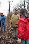
 Earthday Tree Walk
© 2000, W. Saslow
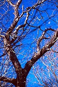 Moon Tree
© 1999, W. Saslow
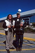 Dana & Matt
© 2000, W. Saslow
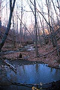 The Valley Floor
© 2000, W. Saslow
 Magnolia Flower
© 2000, W. Saslow
 Woodland Wander
© 2002, W. Saslow
 Wolf Tree
© 2002, W. Saslow
|
Objectives
The objectives for our site trail system are:
- Promote employee environmental and historical awareness through interpretive trails to provide controlled access to natural and historic areas,
- Promote community involvement by inviting local organizations to help survey wildlife and enjoy our wild trails.
- Promote employee fitness through lunchtime jogs and walks,
Read about our mapping initiatives on campus!
Trail Descriptions
The Raytheon property has a number of right-of-way trails for sewer and power lines which, in conjunction with the existing Thomas C. Ligon Trail will provide the basis in which to grow our site trail system. Currently, 3.4 miles of trails are available for walking.
- Birchway Trail (0.25 miles) - Starting from the Tower Trail, the Birchway Trail slopes steadily upward past many young birch trees. Continuing upward, the mag facility, a small building designed for the testing of magnetic systems is seen on the right. A bypass to the Valley Rim Trail is available here. The Birchway Trail continues upward turning to the righ and ends at an intersection with the Valley Rim Trail.
- Crabapple Trail (0.14 miles) - Starting from the Thomas C. Ligon Trail in the building 1 parking lot, the Crabapple Trail slopes gracefully downward past a large crabapple tree where owl pellets have been found. Continuing downward, the Crabapple Trail ends at an intersection with the Tower Trail.
- Thomas C. Ligon Trail (1.34 miles) - This existing trail is the main walking route for lunchtime fitness enthusiasts. It has a level surface suitable for walkers and joggers alike.
- Meadow Meander (0.50 miles) - Following the edge of the lower meadow fields, the Meadow Meander passes the wildflower garden and continues through old farm fields. This is a prime ground nesting area and quite a bit of bird activity can usually be seen. Passing through the stone wall, the Meadow Meander passes into the high meadow, until recently in farm production. This is one of the highest parts of the property and look westward is sometimes rewarded by a glimmering Narragansett Bay. A gentle loop through the meadow returns you to backtrack back to the Thomas C. Ligon trail.
- Tower Trail (0.23 miles) - Starting behind building 1 by the water tower, the tower trail angles downward through areas rich with invasive vines. About 80 yards in, the Woodland Wander trail leads off to the right. Continuing along another 120 yards, the Tower Trail intersects with the Crabapple Trail on the left. Continuing onward, the trail continues to ramp downward 125 yards, intersecting with the other end of the Woodland Wander trail on the right. Continuing downward 93 yards, the Tower Trail intersects with the Birchway Trail on the left before terminating at the Valley Rim Trail.
- Poor Farm Ramble (0.24 miles) - Starting on the tower trail, east of the terminus of the Woodland Wander trail, the trail cuts through a stone wall and passes through the site of the Portsmouth Asylum, a combination Poor Farm and Insane Asylum run in the nineteenth century for the town. A well can be seen on the right, and the foundations of the many outbuildings dot the landscape, depressions in the ground where the coursing mud of a century of disuse, has all but covered its former presence. Buried somewhere here is the infamous "Portsmouth Dungeon", where inmates were punished on bread and water. Impressive "wolf" trees, including "Wild Black Cherry" and "Sycamore Maple," can be seen on the right along the trail as it slowly ascends to intersect with the Crabapple Trail near where it intersects with the Thomas C. Ligon Trail.
- Valley Rim Trail (0.34 miles) - Starting at the end of the Tower Trail, the Valley Rim Trail winds upward on a dirt road along the Lawton Valley Rim. On the right is the historical Lawton Valley, once owned by Julia Ward Howe and site of a grist mill. On the right, 205 yards up, past the perimeter fence is the old Town Farm cemetery [ 1 ] where 36 souls are buried and marked at head and toe without inscriptions with slate and fieldstone markers. The margin between road and brush is alive with birds most of the year. 47 yards up on the left is the mag facility, a small building designed for the testing of magnetic systems. A bypass to the Birchway Trail is available here. Continuing upward 133 yards on the Valley Rim trail, an intersecion with the end of the Birchway trail is found on the left. The Valley Rim trail continues to wind upward to the left and, following the edge of the woodland, ends 216 yards later at the Thomas C. Ligon Trail across from building 3.
- Woodland Wander Trail (0.36 miles)
- The Theme of this Interpretive Trail is "The Emerging Forest". The Western Woodland was not always wooded. From the 1630’s to the 1950’s, it was cleared and farmed, stone walls bordering the many fields for livestock and planting. When the property became Raytheon in the early 1960’s, portions of the land began its natural transition into an "Emerging Forest". Important concepts to be learned on this trail are competitive selection, wildlife food value, and historical uses of the trees and plants of the Emerging Forest. Starting at an intersection near the top of the Tower Trail, The Woodland Wander Trail enters a Red Cedar forest. Typically, these are the first trees to appear on abandoned farms. Their seed cones ripen to pale blue berries high in fat, fiber and carbohydrates. These berries are eaten by birds who pass the seeds, thus dispersing the tree population over a wide area. Native Americans used the strippable bark for bedding and mats. The trail, curving to the right, gradually descends a hillside softly carpeted by generations of Cedar needles. On the right, a Black Cherry tree can be seen. Its sprouts and seedlings are a food source for rabbit and deer. Native Americans ground the fruit with animal fat to create pemmican, an important part of their winter diet. The bark yields hydrocyanic acid, which is used as a sedative and as an ingredient in cough syrup. Continuing onward on the left, a good example of High Bush Blueberry can be seen just off the trail. Native Americans ate the berries of this shrub and made a tea with its leaves that was used to treat sore throats, poor appetites, urinary tract infections and diarrhea. Proceeding through an opening in an old stone wall, the rare Pin Cherry tree can be found in abundance on both sides of the trail. Its fruit is such a favorite of birds, it is sometimes called "Bird Cherry". The Pin Cherry is sometimes called the "Fire Cherry" because of its value as a reforesting tree after a fire. Its seeds are heat tolerant and require high temperatures to germinate. Native Americans ate the fruit and used the bark for decorating baskets. As the trail winds to the left in a hairpin curve down a series of stone steps, a Sycamore Maple can be seen on the right. This European tree was brought to America long ago and is now common in both Newport and Middletown. Though its fruit does not attract wildlife, its high tolerance to salt and air pollution make it a hearty planting for shade. Its bark is used in herbal medications as a wash for skin problems, sore eyes and wounds. At the bottom of the curve is an old Stone-Lined Well [2] dating back to the 1700’s. To the right of the well, a Black Gum Tupelo tree is found. American pioneers used its particularly tough, hard-to-split wood to make wheel hubs. They also used it as a “witness tree” when surveying and recording early deeds; its long life and lack of other uses assured it would remain. Continuing onward the trail passes back through an opening in the stone wall and wild garlic may be seen on both sides of the trail. The trail bends sharply to the right then continues gradually rightward where on the right, a good example of a Sycamore Maple tree is found. Proceeding leftward, the forest opens, allowing Jewelweed ground cover on both sides of the trail to thrive in season. The Jewelweed has a yellow flower in early summer. And its leaves, crushed in a poultice, are a Native American cure for poison Ivy. Up ahead on the right side of the trail, a series of hairy vines climb their way up the trees. This vine is Poison Ivy. 85% of all humans are allergic to urushiol, the sticky yellow oil that is found in all parts of the plant it and remains toxic during its winter dormancy. Descending slowly, the trail turns sharply to the left at the site of a fallen Red Cedar. Continuing on, Red Cedar are dominant along with a few High Bush Blueberry on the right. Exiting the grove, a Sycamore Maple Tree on the right overhangs a flat boulder on the left. Continuing onward, the trail ascends past an Arrowwood tree on the left. It produces small white flowers that ripen into bluish-black berries in late fall, lasting into winter. These berries are preferred by many kinds of wildlife. Native Americans used its stems as arrow shafts and smoking pipes. The Gray Birch, on the left, is a pioneer species which often inhabits burned areas or an abandoned farms. It acts as a nurse tree, protecting the seeds of longer-lived trees that eventually shade it out. Birds and animals do not prefer it as a food source. The trail continues past a patch of Ferns on the right. The trail continues slowly upward passing a Sycamore Maple on the right and a Pin Cherry on the left and emerges at an intersection with the Tower Trail.
- Other Trails - Other trails will be planned based on the results of wildlife and historical surveys.
Trail Links
- A good reference for trailbuilding and maintenance can be found here.
- A good reference for interpretive trailbuilding can be found here.
|
|
Portsmouth, RI Location

Download Trailmap

Tree Fungus
© 2000, W. Saslow

Lawton Falls Closeup
© 2000, W. Saslow
|
Songs of Innocence-Night
by William Blake
The sun descending in the west,
The evening star does shine;
The birds are silent in their nest,
And I must seek for mine.
The moon like a flower,
In heaven's high bower,
With silent delight
Sits and smiles on the night.
Farewell, green fields and happy groves,
Where flocks have took delight;
Where lambs have nibbled, silent moves
The feet of angels bright;
Unseen they pour blessing,
And joy without ceasing,
On each bud and blossom,
And each sleeping bosom.
They look in every thoughtless nest,
Where birds are covered warm;
They visit caves of every beast,
To keep them all from harm:
If they see any weeping
That should have been sleeping,
They pour sleep on their head,
And sit down by their bed.
When wolves and tigers howl for prey,
They pitying stand and weep, -
Seeking to drive their thirst away,
And keep them from the sheep.
But if they rush dreadful,
The angels, most heedful,
Receive each mild spirit,
New worlds to inherit.
And there the lion's ruddy eyes
Shall flow with tears of gold,
And pitying the tender cries,
And walking round the fold,
Saying, "Wrath, by his meekness,
And, by his health, sickness
Is driven away
Form our immortal day.
"And now beside thee, bleating lamb,
I can lie down and sleep;
Or think on him who bore thy name,
Graze after thee and weep.
For, washed in life's river,
My bright mane for ever
Shall shine like the gold,
As I guard o'er the fold. "
|
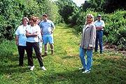
Hiking the Trails
© 2000, W. Saslow

Woodland Wander
© 2000, W. Saslow

Trees Company
© 2000, W. Saslow

Midday Walk
© 2000, W. Saslow

Old Stone Well
© 2000, W. Saslow
|


